
Adam's Guide to Horton Lake near Bishop, CA
Horton Lake & The Eastern Sierras
By Adam B. Widmer
The Eastern Slope of the Sierras and US-395
There’s little doubt that the rugged, majestic Sierra Nevada Mountains are the crown jewels of the California backcountry. But, in reality, most visitors, backpackers, and tourists see only a few small areas of the range. That might sound a bit sad, but if you’re reading this, rejoice! The rest of it is all ours.

Horton Lake
The heavily trafficked places in the Sierras are mostly located in, or accessed by, the western side of the range. Crowded with tourists coming up and down I-5 and California residents sandwiched between the mountains and the coast.
If you instead skirt east around the range and head up US-395 you’ll find a region of profound beauty, like so many others have before. Landscapes ranging from arid desert valleys to pristine alpine forests shaded in pine and aspen. Along just a couple hundred miles of this one road you have access to the oldest living things on the planet in the forests of Bristlecone Pine, the greatest views of Mt. Whitney, several wilderness areas, and some of the best stargazing in the continental U.S. All of it dotted with hot springs for those who know where to look.
As you cut up this magnificent strip of tarmac, through Lone Pine, Independence, Big Pine, and Bishop in the Owens Valley, you’ll see dozens of dusty, unpaved roads. You may wonder: What’s down there?
Do yourself a favor. Go Find Out.

Horton Lake
Down one of these dirt tracks is exactly where I found the Horton Lakes Trail, likely the most beautiful spot I’ve ever camped, from the Smokys in Tennessee, to Glacier NP in Montana, to Yosemite right here in California.
Less than 20 miles west of Bishop via CA-168 and Buttermilk Rd, into the John Muir Wilderness.
Any trip into this area will start on US-395 in Bishop, CA. Now, I won’t lie to you, if you’re in the LA area, getting up here is a bit of a drive. With traffic in your favor, it’ll take about 4½ hours to get up to Bishop from downtown. So it’s worth it to carve out a handful of days if possible and spend some time exploring what the Owens Valley has to offer. However, if that’s not in the cards, the hike up to Horton Lake is fairly short (and extremely rewarding) so you can do as I did:
- Leave immediately from work in the afternoon (this unfortunately means making the drive in darkness and missing gorgeous views along the way.)
- Camp/sleep in the car at one of several campgrounds up CA-168 just outside of Bishop (Sabrina Lake, Big Trees, and Bitterbrush just to name a few.)
- Get up early, pick up your overnight permit in Bishop, along with any other supplies, and be on the trail by around noonish.
- This trek can easily be done as a day hike to those with strong legs and a willingness to start before 9 a.m. If that’s the way you choose to go, there is no permit required. There is, however, quite a lot to explore at the end of the trail. If you wish to take full advantage of all that and camp beside the lake, you’ll need an overnight permit to be legal.

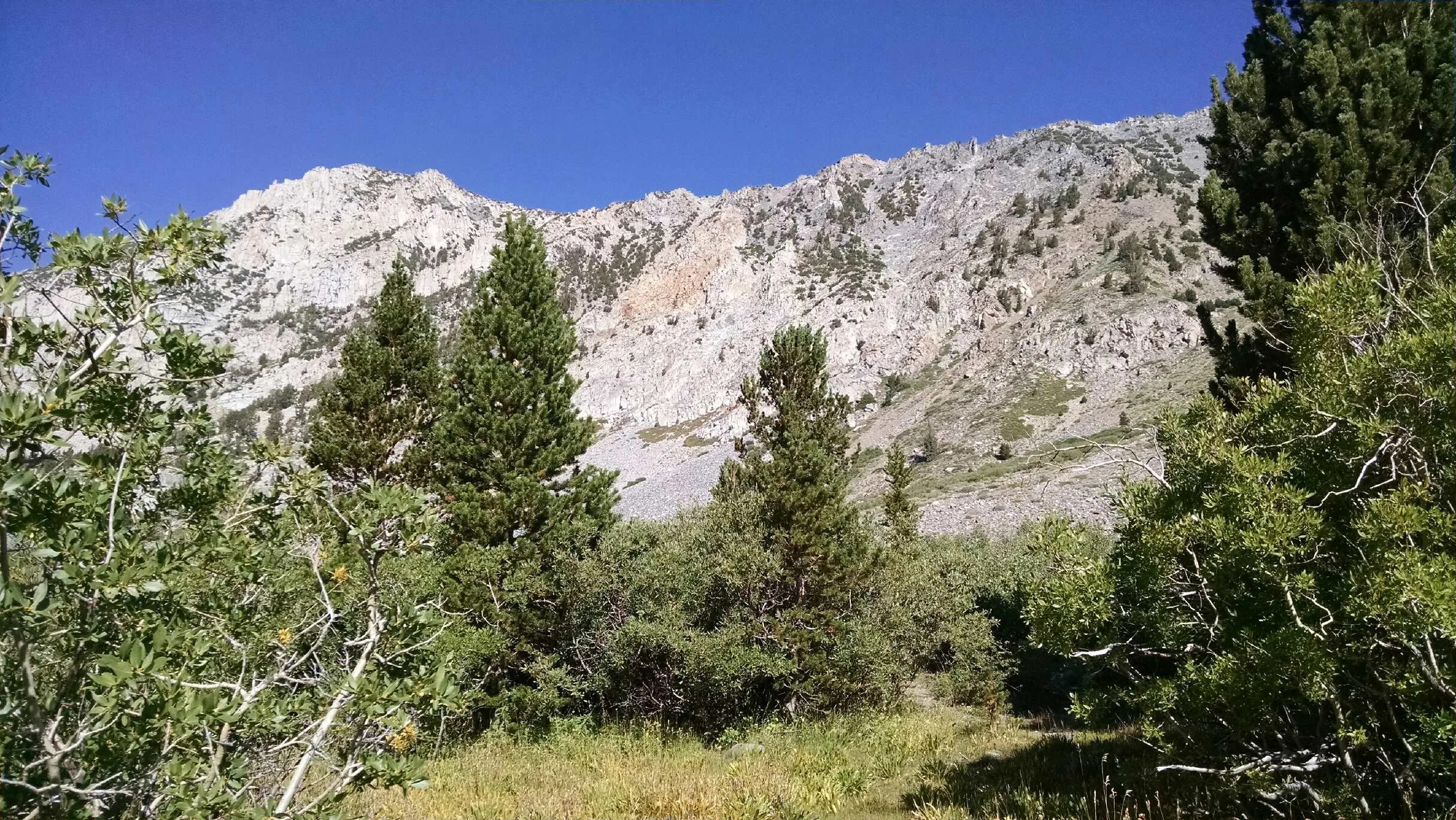
The rugged terrain
Wilderness Permits
Getting a permit for this sort of thing has been made really easy. It can be done online, over the phone, or in person. I chose to do it online via the Recreation.gov website. Getting the permit online does have to be done over 24 hours in advance, and I will be the first to admit that the website is clunky. It can be difficult to navigate, and pretty frustrating to isolate the particular area you’re looking for to find a specific trail. In addition to all that, you still have to go pick up and sign for the permit in person.
But it has one crucial thing going for it: a real time count of how many people have purchased permits to camp at each location.
Let’s face it, no one heads off into the backcountry hoping they’ll find a dozen strangers waiting at their campsite. I have to say, this is actually how I chose to hike the Horton Lakes trail when I decided to make a weekend trip to the Bishop area. I had a good guide book including this trail, and there was no one slated to camp there that night.
They do reserve a certain number of walk-up permits for each camp, to be purchased at the ranger station. This is a great option for spur of the moment trips if you just happen to be in the area, but you can’t buy them until 11 a.m. the day before.
The Trailhead
So after you sign for your permit at the Forest Service’s White Mountain Ranger Station in Bishop, you’ll head west on CA-168. About 7 miles outside Bishop, turn right onto Buttermilk Rd. Buttermilk is paved for less than a hundred yards before turning to a relatively well maintained dirt road. Although it’s unpaved, Buttermilk is easily passable in a normal passenger car as it winds its way gently upward through the desert (much of which is inexplicably owned by LA Power and Water.) A couple of miles in you’ll pass a bouldering spot popular with climbers. On a weekend day there are likely to be several cars in the small parking area beside the road.
Further on, the road gets a bit rougher but should still be doable (with care) in your average sedan.
About 6-7 miles from the intersection of Buttermilk Rd and 168, you’ll turn right onto an old mining road. It can be difficult to know which turn is the right one. There are other turns off to the right before this, and a small Forest Service post with an arrow is all that marks the correct, unnamed path. Just stay on the main dirt road, keep an eye on the mileage, and if you see a signpost and think it’s the proper turn, it probably is.
From here on, it’s advisable to have a vehicle with fairly high ground clearance. I made this drive easily in a small 2wd pickup truck. In any average SUV with 4wd, driven with care, you should have no trouble at all making it to the parking area. If you’re travelling in a sedan, or for some reason are uncomfortable, leaving the vehicles here will only add a mile or so to the hike.
Calling it a “parking area” is a bit generous. It’s really nothing more than an easy-to-miss patch of dust with a fire ring near a small grove of trees. So just take your chosen wheels as far as you think you can go, and try to pull off the road to continue on foot. Keep in mind that up until the actual trailhead, this road is commonly used by 4x4 and dirtbike enthusiasts.
Not far up the road, the way is intentionally blocked by boulders with a small footpath through, and a FS sign. This is the trailhead. Not far beyond, and you’ll enter the John Muir Wilderness.
This is what we came for.
Look up the small valley to the west, and you will see your future. On its north side: Mt. Tom, on its south side: Basin Mountain.

The Trail
The climb begins, and will continue, as a steady haul upward. After about a mile, the trail enters a grove of Aspen trees. They whisper lightly in the breeze and offer sought-after shade. At mile 1.7, a short spur to the right will lead you to the defunkt Sonny Boy Mine, an old tungsten prospect. The main buildings for the mine can actually be seen from the trail, and are well worth a jaunt over to explore either on the way up or down.
Just beyond the Sonny Boy Mine is a small bridge used to cross Horton Creek. Here in this meadow, with a ribbon of Aspen trees running along the creek, is the last place to easily get water until you reach the lake. So drink up, and refill.
Then enjoy a stroll through the meadow awhile before the road begins to climb again. At around mile 2.8, the switchbacks start. Soon you’ll hear, and eventually see, a small waterfall tumbling down below Horton Lake.
The trail will eventually fork, stay left on the main road to continue to the lake (unless you want to climb Mt. Tom, which requires a separate permit. If so, turn right.) Before long you’ll come to a level spot and a cluster of old buildings left over from the Hanging Valley Mining Company, a WWII era tungsten mine developed to support the war effort.
Take a minute to explore what’s left, because you’re almost to your destination. If you’re really in trouble (weather’s pinned you down, someone’s injured, or a pack has rolled down off the trail) one of the mine cabins has a cache of gear, food, and mattresses left for emergency situations. Do us all a favor though, don’t just camp there (you’d probably regret it anyhow).
Just beyond the mining buildings, you’ll dip into a grassy area dotted with Ponderosa Pine as the air grows a bit cooler down toward the lakeshore. There are plenty of nice, level places to pitch a tent down by the lake, just make sure to keep your distance from the shoreline and the established cooking area. I was told by rangers that bear activity isn’t very common here, but not unheard of. So store food and scented items appropriately.
All around the clear, placid lake are towering granite peaks, lush alpine greenery, and clear sky. Boulders sit almost at random on the valley floor. While meditating by the water I was occasionally stirred by jumping fish, or the feeling that one of the larger trout in the shallows was staring at me.
Camp was quiet. My first real solo, and it felt strange. I always come to the mountains to be alone, but had never felt quite so alone there before. An afternoon sprinkling of rain had me huddling around the stove as water boiled for dinner. I laid in my tent that night, with my head hanging out the zipper door. Stars and sparse clouds swirled overhead in the crystalline sky.
Mornings are always early when you’re backpacking, and I cleared up camp while my stove boiled away for a quick round of coffee and breakfast. With a short hike back, there was plenty of time to continue exploring around the lake and wondering what each of the old buildings was used for. And what had disappeared from the landscape entirely.

Campground with a view
If I had another day, Horton Lake would’ve been a great base camp to climb Mt. Tom (again: requiring its own permit) or wander up to Upper Horton Lake, which is about 1.5 miles and 900 feet in elevation from my camp.
The best part about hiking in on a trail that is almost entirely uphill: it’s downhill all the way back.
On the way in I spent about 3½ to 4 hours hiking from my truck to the lake, albeit leisurely. On the way back I tore through the same distance in a little less than two. Savoring a good rest and a bit of shade by the truck, which was now accompanied by a couple other vehicles belonging to the hikers I had passed on my way down.
Bishop, CA is a great little town, and when you’re coming back from any of the trails I highly recommend stopping in for whatever refreshments suit you best. At least one of the bars in town is open at noon.